
bergfex: Hiking & Tracking for Android
bergfex: Hiking & Tracking is a sports app from bergfex GmbH for planning hikes and navigating trails with GPS.
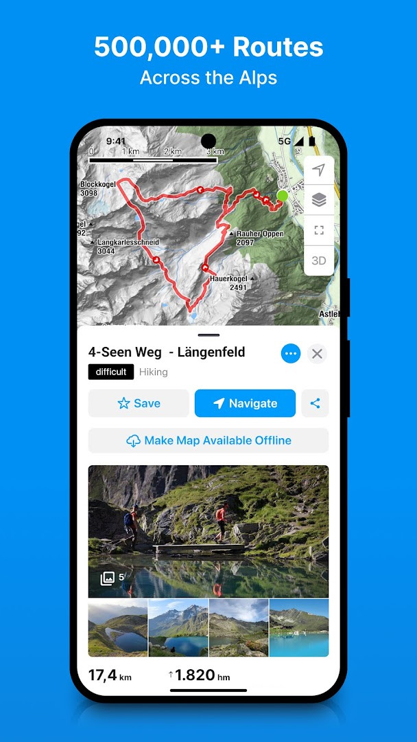
Download bergfex: Hiking & Tracking · v4.55.3bergfex: Hiking & Tracking suits hikers, ski tourers and other outdoor users who want to plan a route and follow it on the go. The app is free to download and runs on Android 7.0 and later. It holds a catalog of over 500,000 tours and maps from OpenStreetMap for the Alpine region, and GPS use can noticeably reduce battery life.
Screenshots
- Version
- 4.55.3
- Requires Android
- 7.0
- Updated
- Oct 13, 2026
- Installs
- 1M+
- Rating
- ★ 4.17 (11,963)
- Category
- Sports
- Developer
- bergfex GmbH
- Content rating
- Everyone
- Package
- com.bergfex.tour
- Free
- ✓ · Contains ads · In-app purchases
bergfex: Hiking & Tracking is a sports and outdoor navigation app by bergfex GmbH that helps users find, plan, navigate, and record hiking, ski touring, running, and mountain biking activities. It combines a large route database with GPS tracking and detailed Alpine maps, making it a practical companion for both casual walkers and experienced mountaineers. The app is free to download, though a PRO subscription unlocks additional tools such as offline maps and avalanche warnings.
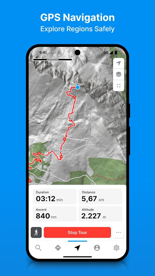
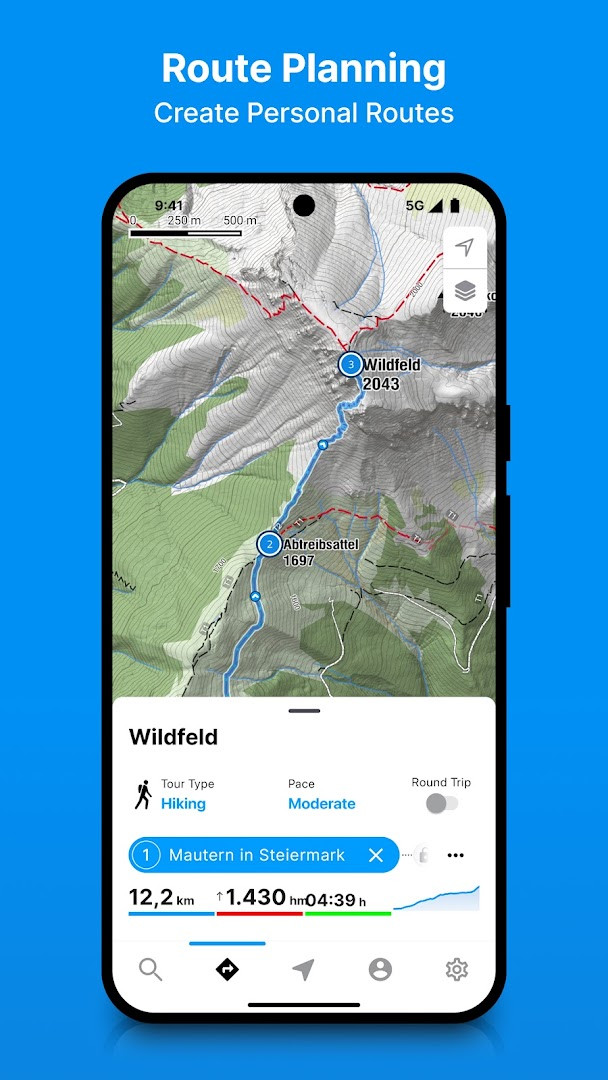
At its core, the app gives you access to more than 500,000 routes throughout Europe, each with tour descriptions and topographic detail. Filtering options help narrow down options by activity type, difficulty, or location. If none of the existing routes fit, the built-in tour planner lets you create a personal route in a few steps. Once you are outside, the GPS navigator keeps you on track even in remote mountain areas where mobile signals may be weak.
The current version 4.55.3, updated on 2026-10-13, focuses on maintenance rather than new functionality. The release notes mention bug fixes and minor improvements, and direct users to contact support by email if questions or problems arise. This suggests a stable, mature app that is being actively maintained rather than undergoing major interface changes.
Key features
- Searchable collection of over 500,000 hiking, ski touring, running, and mountain bike routes across Europe.
- Tour planner for creating personal routes with turn-by-turn GPS navigation.
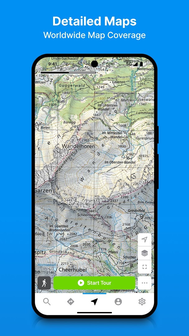
- Topographic maps for the entire European Alpine region based on OpenStreetMap data.
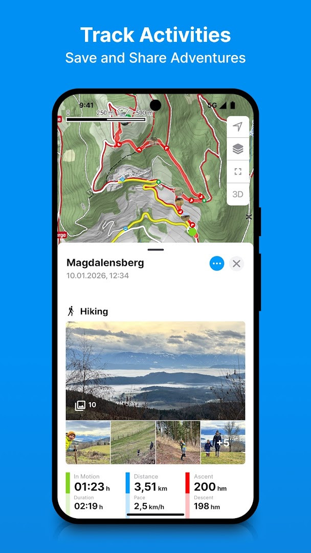
- Activity tracking with statistics for duration, altitude meters, elevation profile, distance, and speed.
- Heat map showing all previously recorded outdoor activities.
- Optional Bluetooth heart rate monitor support for more detailed fitness tracking.
- Automatic synchronization with Garmin Connect, Polar Flow, and bergfex accounts.
- GPX import and export for managing self-created routes.
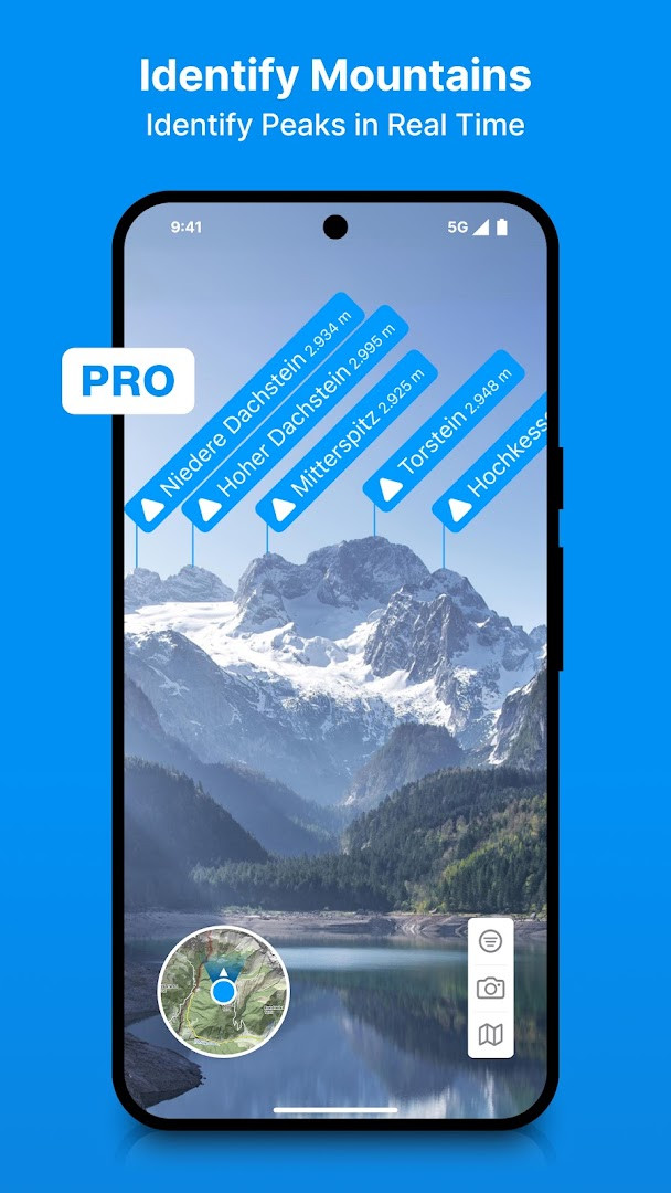
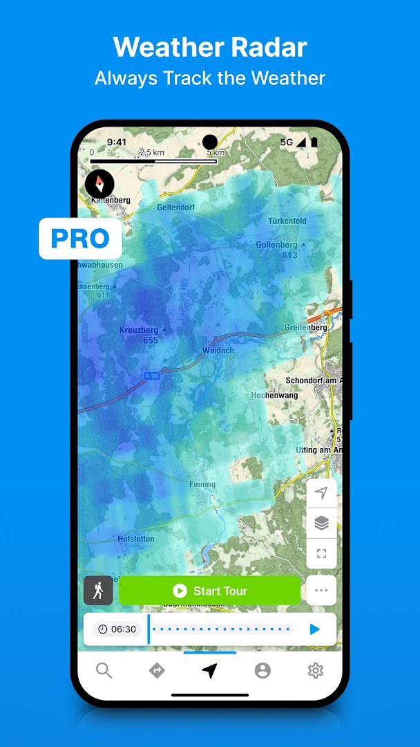
- PRO features include offline maps, peak names, rain front animation, slope steepness overlays, 3D maps, route deviation warnings, avalanche warnings, and live location sharing.
How to install
- Tap the download button on this page to get the APK file.
- If Android asks, allow your browser or file manager to install apps by enabling the 'Install unknown apps' setting.
- Open the downloaded APK file. The file size is n/a.
- Tap Install and wait for the process to complete.
- Open the app and register or sign in to start exploring routes.
- The app requires Android 7.0 or newer.
Pros
- Large database of over 500,000 routes across Europe.
- Detailed OpenStreetMap-based topographic maps for the Alpine region.
- Comprehensive activity tracking with altitude, speed, and elevation profile data.
- Synchronization with Garmin Connect and Polar Flow.
- 7-day free trial of PRO features without commitment.
- Useful safety features such as route deviation warnings and avalanche alerts in the PRO version.
Cons
- Continuous GPS usage can significantly reduce battery life.
- The free version includes advertising.
- Several helpful features, including offline maps and avalanche warnings, require a PRO subscription.
- Some advanced map layers and live location sharing are locked behind the paid tier.
Latest changes · 4.55.3
Version 4.55.3 of bergfex: Hiking & Tracking arrived on October 13, 2026. This release resolves bugs and adds a few smaller refinements. If you run into any issues or have questions about the app, the developers invite you to get in touch by email.
Older versions
| Version | Size | Requires Android | Updated |
|---|---|---|---|
| 4.55.3 | — | 7.0 | Oct 13, 2026 |
This app suits regular hikers and ski tourers who want reliable GPS navigation and route discovery in the Alps and broader Europe. It is also a good fit for mountain bikers and trail runners who like to track performance metrics and review a heat map of past activities. Casual weekend walkers can use the free version comfortably, while dedicated outdoor enthusiasts will get the most from the PRO subscription.
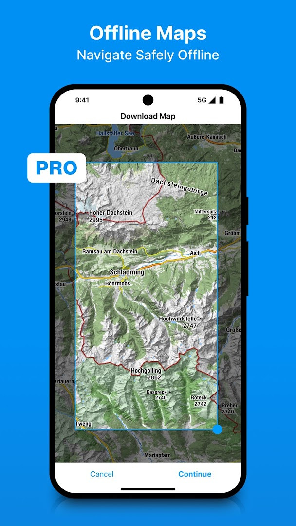
Download offline map sections for your planned route before heading into areas with poor mobile coverage, especially if you subscribe to PRO. This keeps navigation working when you lose signal and helps preserve battery life by reducing the need for constant data connections.
Permissions
FAQ
What kind of official map material can I unlock during the PRO trial?
Yes, with the PRO trial you get access to official hiking maps such as ÖK50 and SwissMap, plus 3D maps and a satellite map with points of interest.
How does the app work with external platforms like Garmin Connect or Polar Flow?
Tracked activities can be displayed in Garmin Connect and Polar Flow, and self-created routes can be exported or imported via GPX files.
What statistics appear after recording a hike or ski tour?
Statistics include duration, altitude metres, elevation profile, distance and speed. A heat map also shows all activities you have recorded so far.
Can using GPS navigation affect my phone's battery?
Yes, the description notes that continuous GPS usage can result in a severe reduction in battery life.
Which PRO features are aimed specifically at safety or route awareness?
PRO features include a warning signal when leaving the route, slope steepness overlays, live location sharing, and zones for heart rate measurement.
For hikers, ski tourers, and mountain bikers who want a single tool for route discovery, planning, navigation, and activity tracking, bergfex is a strong and practical choice. The free version is genuinely useful, while the optional PRO subscription adds meaningful offline and safety features. Just be aware that continuous GPS use will drain the battery faster, so carrying a backup power source is wise on longer outings.
Similar apps





Updated: Oct 19, 2026